Monday, February 27, 2017

Cave Cay: Another Change of Plans

Tuesday, February 21, 2017

After deciding to run South and hide at Cave Cay, it took us about an hour to get the outboard off the dinghy and put the dinghy back up on the deck.  From past experiences, I prefer not to try and get into an unknown marina slip with a dinghy in tow.  Pearl had left almost immediately, and they go about a knot faster than us, so they were out of sight by the time we hauled anchor.

The winds were light but favorable, and under other circumstances we would have just sailed.  But we were hearing increasing numbers of boats inquiring about slips at Cave Cay on the radio, so we wanted to get there ahead of the pack.  We motor-sailed with the jib only, and maintained about 6 1/2 knots the whole way.

Four hours later, we approached the narrow, rocky entrance to Cave Cay marina.  Once inside, we found a large, rectangular harbor with floating docks at the far end. Apparently, this was once a natural inlet, but had been dredged to make a usable harbor.  It is totally protected on all sides by rocky hills.  There were still plenty of slips left, but they were filling up fast.  The slips are gigantic, big enough to hold two boats of our size in a row.  Obviously intended to accomodate large power boats, of which there were many here.
Cave Cay Marina
Dolce Vita tucked in between two large power boats
The dockmaster, "Shark", was very friendly and helpful, getting us settled in and explaining the facilities.  Two welcome surprises were that the RO (reverse osmosis) drinkable water was free to marina guests, and that even though they don't sell fuel to the public, they would make it available to marina guests.  This was a relief, as fuel and water were two of the things we were going to get at Staniel Cay had we not made our run for shelter.

It had been about two weeks since we filled our water tanks, and we were still operating on our main 40 gallon tank.  I thought is was about empty, but was later astonished to find that we had only used 25 gallons!  Our conservation efforts had really been effective!

The entire island of Cave Cay is privately owned by a Texan. He's there every day, and is quite pleasant to talk to. It's clear that he's sunk enormous amounts of time and money into the place, but it appears to be stuck in limbo.  Several guest buildings, a large restaurant building, and a marina office and store are all "under construction" and nearly complete.  But its clear that they have been that way for a long time, and are already starting to deteriorate a little.  Apparently there's some sort of a problem getting the proper operating permits from the Bahamian government.  He currently has the island up for sale.  For a mere $90 million, complete, you too can own your own island in paradise!

Wednesday, February 22, 2017

The front wasn't due till late tonight/early tomorrow, so we spent the time doing a little exploring.  The island has its own airstrip, and small private planes use it.  Even the seaplane occasionally lands there when conditions are too rough on the water.
Seaplane after making a supply drop-off.
We got together with Bruce and Gayleen and hiked up to a rocky beach on the Exuma Sound side of the island.  The beach was good for collecting shells, sea glass, and the occasional live sea creature.
You got a problem??!
Large Conch Shell
Exuma Sound
Hard, compacted sand eroded into fantastic shapes


Thursday, February 23, 2017

A cloudy, drizzly, windy day.  Mostly stayed aboard and read.  Was able to top off water and fuel tanks and get all jugs filled, so we're all set there.


Now we had a decision to make.  Since we had skipped a lot of stuff on our run here, we could either just skip it, go back north to cover it before continuing on south, or change our overall plan.  Having fuel and water gave us options, as we were no longer forced to go back North to Staniel Cay for it..  And looming over all of that, way in the background of our thoughts, was the fact that we needed to be back in the Chesapeake by June.  It sounds like a long time, but if we take 5 or 6 weeks going up the ICW, as we did coming down,  that means that we need to be back in Florida in only 6 or 7 weeks!   This probably wasn't going to be enough time to complete our original "big loop" plan and go through the out islands of Long Island, Cat Island, Eluthera and the Abacos.

So, what we've decided to do is continue on South to Georgetown, spend some time there, and then work our way back up the Exumas, catching the stuff we missed, and seeing if there's enough time to make a hop over to the Abacos.  Otherwise, it'll just have to wait for the next time! :)

Friday, February 24, 2017

The morning dawned cloudy and still windy from the west.  A rainshower decided us to stay for another day to let the seas calm down.  A later hike up to the hill overlooking the Banks side confirmed that this had been a good decision, as there was still a lot of choppy wave action that would have been on our beam, making for uncomfortable travel.

Things cleared up before sunset, and we had an impromptu gathering of cruisers on the deck of the office building for sundowners. Most of them are leaving tomorrow too.


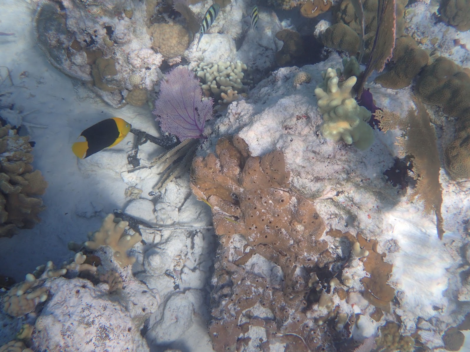
In the morning, we'll make a short trip to Rudder Cay to do some snorkeling there.

Life is good.

Thursday, February 23, 2017

Big Majors Spot: Pigs and Pirates

Monday, February 20, 2017

After spending an extra day staying put at Cambridge Cay due to rain, we dropped the mooring and headed for Big Majors Spot.

I've yet to figure out the naming conventions here.  Most of the time, the small islands are called Cay (pronounced Key, not Kay).  But sometimes, they're "Wells" instead (Warderick Wells, Spanish Wells).  But these two islands are Big Majors Spot and Little Majors Spot!  No apparent reason.

Anyway, Big Majors Spot's claim to fame are the feral pigs that live there.  They've gotten so used to people feeding them, that they come out looking for handouts.  They even swim out to the dinghys and try to climb in if there's food aboard!

Unfortunately, we got to the beach about 3 in the afternoon, and the pigs had all had their fill and were off sleeping.  Except for one large sow.  She was eating from a large pan that one of the locals had provided. Joanie caught a glimpse of a piglet headed into the bush for his nap.

The various guide books all say that the pigs particularly like carrots.  Well, everybody reads the same guides, and there were dozens of carrots scattered about, uneaten.  I guess its too much of a good thing!

The sow was busily chowing down on her slop, when Joanie offered her a chunk of squash.  Aha! Something new!  The pig quickly gobbled it down and nosed for more.
What's that?  Smells Divine!
I want it!
Gimmee More!
 We found out that a day or two prior, someone had fed the pigs spoiled food and they came down with food poisoning.  Seven of them died! This is a pretty major hit on a population of only around 30 pigs, so the locals were carefully supervising what was being fed to them.  There's now talk of restricting dinghy access to the beach, and limiting the number of visitors.

We had planned to return in the morning, when the pigs are hungry and all show up, but those plans got foiled (more on that later).

After leaving Pig Beach, we cruised around the island and found a small beach with tables, umbrellas, and a lot of colorful markers bearing boat names.  It's called Pirate Beach, and the facilities are all donated by cruisers.  Its a place for people to gather to share sundowners and snacks, and watch the sun set.  We called Bruce & Gayleen on Pearl and asked them to join us there before sunset.  Several other cruisers showed up as well.  One had a conch shell horn to announce the sunset in the transplanted Hawaiian tradition.
Pirate Beach
Somebody Wants to Claim the Whole Island!
Even the picnic tables get decorated
Cruisers & Sundowners
Awaiting the Main Event
Sunset


Tuesday morning, we met with Pearl to discuss weather. We had planned to stick around here one more day, and then move a short distance to Staniel Cay for fuel, water, and food provisioning.  But the weather report showed a cold front coming on Wed/Thurs, with strong West winds up to 30 kts, and the possibility of rain squalls with winds up to 40 gusting to 50!  This area is TOTALLY unprotected from the west, and there are few protected anchorages nearby, and they were already filling up! 

So, we had two choices.  Either backtrack to Cambridge Cay and take a mooring, or make a 23 mile run south, skipping several stops we wanted to make, in order to reach the totally protected, but little known, marina at Cave Cay. We decided to follow Pearl south to Cave Cay.  We'll have to figure out what we'll do afterwards.

Life is still good.


Sunday, February 19, 2017

Cambridge Cay

Friday, February 17, 2017

Now that the front has passed and the seas calmed down, everybody's going to be leaving today. Reasoning that the same thing woud be happening at Cambridge Cay mooring field, we got up extra early to get ahead of the "rush" and get to one of the vacated moorings there.  On the way, we contacted Pearl on VHF and they confirmed that there were available moorings, and more boats were departing.

The trip was a short motor-sail, less than 3 hours, and we picked up the mooring without incident.  Joanie is becoming quite the expert at capturing and tying up to a mooring pendant. 

Pearl was anchored just north of the mooring field.  We arranged to meet up with them after lunch and they would take us on a long-distance dinghy trip to some prime spots.

The first leg of our dinghy expedition took us about a mile and a half South, across Conch Cut, into the northern end of Compass Cay.  There we beached the dinghys and walked along a shallow creek to the far side of Compass Cay to a location known as "Rachel's Bubble Bath".  This is a large sand pool just inside a rock wall that separates it from the Exuma Sound.  A low gap in the wall allows waves to crash through and fill the pool with bubbling foam. (click on any of these thumbnails to see the full resolution photo)

Rachel's Bubble Bath
Unfortunately, the effect is best at high tide, and we were already halfway to low tide (the best time for snorkling) so only the occasional wave barely made it through with just the tiniest bit of bubbles.
Tiny Bubbles
Next, we traveled about 3/4 mile west, to a small pair of rocky islands called Rocky Dundas.  Once again, the park has provided dinghy moorings so you don't have to damage the bottom by anchoring.  We moored and got on our snorkel gear.
Moored at Rocky Dundas
In addition to some nice coral beds, the main attraction here are the two large cave grottos!  Wave action has undercut the steep shoreline rock, and in two places, it has eroded through into a large dome-shaped cave that extends all the way to the surface.  At mid to low tide, the waterline is below the undercut, and you can swim right in.
Going Into Grotto #1
When you pop out from under the entrance ledge, the first view is breathtaking.
As You Clear the Entrance
Light streams in through the small overhead opening, giving the whole scene a cathedral-like quality. 
Inside Grotto #1
Back outside, the second grotto is just to the south.  A giant underwater coral "tree", about 8 foot across, stands outside the entrance to grotto #2.
Giant Coral Tree
If possible, this grotto is even more spectacular than the first!
Going Into Grotto #2
Just Past the Entrance
Inside Grotto #2
The Way Out

For the last leg of our dinghy trip, we traveled 3/4 mile North, back across Conch Cut to Cambridge Cay, not far from the mooring field.  We beached the dinghys on a wide, shallow sand beach, and followed a twisty trail through the dense palmettos to large beach on the far side known as Honeymoon Beach.
Cambridge Cay
Trail Through Dense Palmettos
Deep, Dark Blue Waters of the Exuma Sound
Strange Looking Sponge Washed up on Shore


That evening, we dinghy'd over to Pearl for sundowners and snacks with Bruce & Gayleen, their son Brandon, and his girlfriend Sophia.
Gayleen, Bruce, Sophia
Bruce, Sophia, Brandon
The 1/4 mile dinghy ride back to Dolce Vita in the pitch black darkness was a little erie.  Thank goodness we had a powerful light along, and had left on the anchor light on Dolce Vita.  Otherwise, we might still be wandering around out there! ;)

Once again, after a long and wonderful day, we tumbled into bed.

Life is good.

Saturday, February 18, 2017

Warderick Wells

Sunday, February 12, 2017

Today, we head for Waderick Wells, the headquarters of the Exuma Cays Land and Sea Park.  This is one of the high points of the trip, and we have been eagerly looking forward to it.  Yet its hard to imagine how anything could be better than all we've already seen and experienced!

The wind was out of the East, coming directly off of Shroud Cay, and the moorings were arranged in a staggered line parallel to the shore.  I looked at that and thought "Let's try and sail off of the mooring without using the engine!"  We had never attempted anything like that before, but it looked like the ideal time to try.  It LOOKED to be straightforward.

And it was!  We got the main up, cast off the mooring lines, and fell back, letting the wind fill the main, and we were underway! As we turned downwind and accelerated, we were easily able to clear the adjacent boat. It looked like we knew what we were doing!  I was elated with our success.

We quickly got the jib up and were under full sail, making better than 5 knots.  We were able to hold this about halfway to Warderick Wells, where the narrow approach into the harbor required turning up into the wind and starting the engine.

The northern mooring field at Warderick Wells is a sight to behold. A narrow (and I mean NARROW) channel of navigable water snakes close to the shoreline on one side, and a large sand flat on the other side.  Its barely two bost lengths wide!  And the moorings are strung in a curving row right down the middle!  Under normal circumstances, I would have NEVER even attempted to enter such a channel, let alone anchor there!

Narrow Mooring Field: The Thin Blue Stripe
So, in  we went.  The positions of the moorings means you have to decide which side to pass each moored boat on.  And the sun was ahead of us, so we couldn't read the water depth from the color.  Of course, I chose one wrong, and we ran aground softly in the sand. It was easy to get off, and I learned that you have to pass within spitting distance of each moored boat!

We picked up our assigned mooring ball (#11) without further incident.  It was amazing.  Our stern swung to within less than a boat length of the rocky shore on one side, and similarly to the sandbar on the other side!  Yet we remained in plenty of depth.  But there would be no sailing off of THIS mooring!
Dolce Vita Moored at Waderick Wells
Once on the mooring, we lowered the outboard onto the dinghy and puttered around the anchorage meeting some of the other cruisers.  Since it was Sunday, the park office was closed, so we couldn't check in until Monday morning.


Monday, February 13, 2017

We dinghy'd ashore to the ranger station's dock to register and began our exploration.  At the station, we bumped into Nick & Rachel (M/V Sandy Gal II) who we had met in Bimini.  They joined us in a walk on one of the trails up to Boo Boo Hill.

Boo Boo Hill is one of the highest points on Warderick Wells.  The legend is that on a calm night, you can hear the wailing of the lost souls that were shipwrecked on the reef.  Or maybe it's just the wind whistling through the jagged rocks. In any event, cruisers leave a token atop Boo Boo hill with the name of their vessel in order to appease the spirits to grant them a safe passage.

Over the years, an enormous mound of driftwood has accumulated, inscribed, painted or woodburned with the names of countless cruising boats.
Mound of Markers
We were unprepared for this tradition, and vowed to return after cobbling together a suitable marker.

While we were up there, we bumped into our mooring neighbors Ron & Phoebe, also out on a hike.
"Next Door" Mooring Neighbors Ron & Phoebe of s/v Noodin.
All along the trails, there are countless curly-tailed lizards. They seem quite unperturbed by humans, allowing them to pass quite close before scurrying away, and then not very far.
Curly-Tailed Lizard
After returning from the walk, we went snorkeling on one of the small coral beds inside the harbor called "The Ranger's Garden". The park provided miniature dinghy moorings so you wouldn't tear up the bottom by anchoring.
Coral
More coral
A Seargent Major
A Yellow & Black "Rock Beauty"
Sponges
That evening, we had Ron & Phoebe over for sundowners.

It was a long and fun-filled day.  We slept well that night!


Tuesday, February 14, 2017

Today was a work day.  When we left Dolce Vita in Florida for a month at Christmas, she started growing some alge just below the waterline because we weren't moving her every day.  This had gotten steadily worse until it looked like we had a green beard.  The bright green filaments were over an inch long! 

And its stubborn stuff to remove.  It took the two of us all day, lying in the dinghy alongside and using scrubbrushes to remove it.  But the waterline is now nice and clean, and the reduced drag will let us sail better, and burn a little less fuel when motoring.

Afterwards, we scrounged up a broken piece of a wooden cutting board in one of the lockers, and Joanie produced paint and markers and worked her usual artistic wonders creating a marker for us to place on Boo Boo Hill.

Ron & Phoebe had us over for sundowners that evening.


Wednesday, February 15, 2017

The cold front we were waiting out is passing through today.  It brought with it lots of wind, and scattered rainshowers.  The water was churned up and the snorkeling wouldn't have been any good, so we spent a lazy day reading.  Late in the afternoon it cleared up enough to make another hike up Boo Boo Hils to place our marker and appease the spirits.  One can't be too careful! ;)
Our Marker, with Dolce Vita in the Background

Thursday, February 16, 2017

Our last day here.  The weather was still a bit overcast and a bit cool for snorkeling.  We tried using a lookey bucket (a 5 gallon bucket with a clear plastic bottom) from the dinghy (called "bucketing") to view the bottom, but things were still too stirred to see much. Along the way, wt stopped and talked with Mark & Cindy of s/v Cream Puff.  They had been moored near us at Shroud, but we hadn't met them then.

In the end, we went back ashore and took a longer hike along the Causeway trail to the southern part of the island, seeing sections of shoreline and part of Banshee Creek that we had not seen before.  The scenery continues to be incredible.

We are having the time of our lives.
Happy Cruisers
Tomorrow morning, we will depart for Cambridge Cay, which is also in the park, but totally untouched by any human constructions.  We hope to meet up there with our friends Bruce and Gayleen aboard s/v Pearl, who will show us some good snorkeling spots.

Life is good!

Thursday, February 16, 2017

Shroud Cay

Saturday, February 11, 2017

This morning, we got up early to make the very short (7 mile) trip to Shroud Cay, where we picked up a mooring ball. We were amused to note that the straight-line distance back to Norman's Cay was only a few miles, and we could easily see the mound of construction rocks at the south end of Norman's that were being used to create a new breakwater for the coming resort that is being built there.

The early start gave us most of the day to do our exploring in and around Shroud.  Shroud Cay is the first of several islands in the Exuma Cays Land & Sea Park.  It is completely protected and undeveloped.  This particular Cay's main features are the large mangrove swamps in its interior, and the large beach on the Eastern side, away from us.

Once settled in, we dropped the outboard back onto the dinghy and took a quick ride to shore, pulling up on the small beach there. The shoreline is rocky and steep everywhere else.  We noted the short climb up to the honor-system payment box, located well above any possible high-water mark.  We would come back there later to to pay our $20 mooring fee for the night.

Mostly Rocky Shoreline
Honor System Payment Box at the Top of the Hill
Shroud Cay has several main creeks into its interior.  All but the northernmost one are restricted to unpowered vessels only, such as kayaks, while the north creek permits motors but only at idle speed, less than 3 knots. We set out in the dinghy for the north creek, about a mile and a half away across shallow flats.
North Creek, Off in the Distance
Once there we entered the wide, shallow creek mouth.  It was low tide, so we had to pick our way in among the sand bars, sometimes getting out to lift the dinghy over them.

North Creek Entrance
Warning Notice: 3 kts and NO JetSkis
Mangrove Roots Line the Creek Shore
A short ways in, we encountered a side creek on the left.  We knew, from previous conversation with other cruisers, that this fork led deep into the Mangrove swamp, while the main creek on the right led all the way through to the beach on the eastern shore of the island.  We decided to go up the side creek first.
Side Creek into Mangrove Swamp
It was too shallow for the motor, so we raised it and got out the paddles. Immediately, we encountered a sandbar that required us to get out and portage the dinghy over it.

Portaging Dinghy over Sandbar
Shortly after we got back in, we startled a 2 ft nurse shark!  But he darted away quickly, much more afraid of us than we were of him!

We pressed on as far as we could go, eventually getting to the point where it was too narrow for the dinghy.  We had to back it out to a point that was wide enough to turn around.
Deep in the Swamp
The Last Wide Spot
Afterwards, we went back to the main creek and tried to get through to the beach on the eastern shore.  But low tide defeated us.  It was just too shallow to get the dinghy through.  Oh well,  its something to save for the next trip! ;)

Once we returned to Dolce Vita, I grabbed a $20 bill and a pen and we headed back to the beach to climb up to the payment box to put our money in an envelope and fill out our info.  The view from the top of the hill was worth the climb.
The Job's Not Over 'till the Paperwork's Done
Dolce Vita in the Mooring Field
Tomorrow, we'll head to the Park Headquarters at Waderick Wells.  We'll probably stay there several days waiting for another cold front to blow through because its well protected from all sides.


Life is good.