762 nm N31 40.065 W081 10.213
Today, we would pass through one of the two worst spots on the Georgia portion of the ICW: the appropriately named "Hell Gate". This area has shoaled so bad that it is impossible to get through at low tide. So we needed to time our arrival there to avoid low tide.
But there's more. In cases like this, it's best to arrive during a mid rising tide. This way, there is about 4 ft of extra water (they have 8 ft tides here!), and if you do run aground, the rising tide will soon float you off. If you happened to run aground during a falling tide, you could be stuck there for 6 hours waiting for the tide to cycle back around!
So, all of this makes this section of the ICW very technical. There are several of these shallow spots, and it's almost impossible to get through more than one of them per day because the tides don't line up properly. So you schedule short hops.
So, we planned a short day, with a later start at 9:00am that would get us to Hell Gate at the right time, and later allow us to anchor on Walburg Creek, where we would be positioned for the next day's run through the #1 worst spot: Little Mud River.
After all this detailed planning, the actual passage through Hell Gate was pretty anti-climactic. The depths were never close to a problem, although I did note that there were two spots that would have been less than 4 1/2 ft at low tide.
Along the way, we stopped at Kilkenny Marina for Gas and water. This appeared to be some kind of hunting and fishing club, and it was a mile and a half off of the ICW, but they were very friendly and helpful. The claimed to be the last fuel southbound for the next 67 miles. This no doubt justified their high price and 3% credit card surcharge, but that's the way a free market works. Without them, I would have been going into my reserves the next day.
The rest of the day passed without incident. The passage across Sapelo Sound was quite rough, with wind driven waves from the North and ocean waves from the East causing confused seas. Once across the sound, we entered the top of Walburg creek (for some reason, Google maps refers to this as Blackbeard Creek). This took us off of the ICW, but Walburg rejoins the ICW at its South end. Our plan was to exit there in the morning.
A couple of other boats that we had talked to along the way were already anchored in the upper parts of the creek, but as usual, we wanted the shallower stuff. And we had anchored here on our way north on our last trip.
So, emboldened by our success at finding shallower water the last two nights, I proceeded onto the area marked on the charts as 5.9 ft at low tide. It was almost low tide , with just over a foot to go. I should be seeing about 7 ft depths. But the water was deeper than expected, A lot deeper. 12 ft to be exact. This would be 19 ft at high tide, too deep for us. I kept probing. Suddenly, the depths began to fall rapidly. I cut the throttle and turned hard to retreat the way we came. Halfway thru the turn, the depth alarm went off (6 ft) and we went hard aground, with the depth showing a little over 4 ft!
I tried our usual stunt of using the hard-over rudder as a "stern thruster" to spin us around to point back to deeper water, but we only turned a little and stuck hard. The wind was on our beam, so we unfurled the jib and sheeted it in tight. We heeled over and I tried applying throttle. We started to move forward, but then struck another ridge and no amount of throttle would budge us. Furling the jib back in still left us heeled over about 12 degrees. We were stuck for the duration.
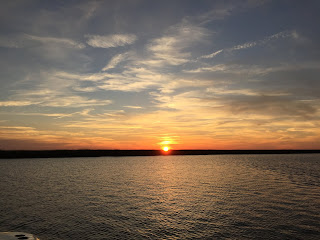
Since this was towards the end of a falling tide, I figured we would need 2 to 3 hours before we would be able to float free. This would be after sunset, so it looked like we would be anchoring in the dark today. :( After that, there was nothing to do but enjoy the spectacular sunset.
At full low tide, our depth sounder read 3.7 ft.
After 2 hrs and 40 min, we floated free and powered away. I settled on anchoring in 11 ft of water, which would become 18 ft at high tide. With my limit of 70 ft of anchor rode (to keep from wrapping the nylon part rode on the propeller), this gave me less than 5:1 scope at high tide, and I'm not comfortable with that. For the first time on the trip, we felt the need to set an anchor drag alarm.
I really do hate anchoring in Georgia.
So I learned a lesson in humility. But nothing got damaged (besides my ego and the paint on the bottom of the keel!) , and no real harm was done. And the anchor alarm remained silent all night.
So life is still good.


Ed, if you made it all the way to Georgia before running aground you are doing OK...and it wasn't while transiting, you were exploring for an anchorage...totally acceptable circumstances to feel your way to find good anchorages!
ReplyDeleteCheers,
Shawn
Oh, and I really like the google maps link in the Lat/Lon now...Cool Stuff!
ReplyDelete