Wednesday, October 31, 2018

Calabash Creek

495 nm   N33 52.436   W078 34.207

Today would take us past Carolina Beach,  through Snow's Cut, down the notorious Cape Fear River, through some of the worst shoaled sections of North Carolina.  Our ultimate destination would be Calibash Creek, a small anchorage off of the Little River inlet, just over the South Carolina border and just north of Myrtle Beach.

But first we backtracked to the Wrightsville Beach Marina at first light for the promised pumpout.  Once there, the young girl on duty informed me that she couldn't do a pumpout!!  But she did offer to let me do it, which was fine with me.  However, when she tried to start the pump, nothing happened!  A call to the dockmaster revealed that the pumpout was out of commission, and suggested I try Seapath!!

So much for that!  Meanwhile, we wasted a half hour of precious daylight.  So, based on their obscenely expensive gas ($4.51/gal!!) and poorly instructed staff, I cannot recommend Wrightsville Beach Marina for anything!  Do yourself a favor and stay away!

Along the way to Carolina Beach, we saw occasional boats up on the marshes, a grim reminder of the power of these storms.


The ride down Snow's Cut had the current in our favor, and was a real "sleighride", with the GPS reporting our speed over ground as over 8 knots!!

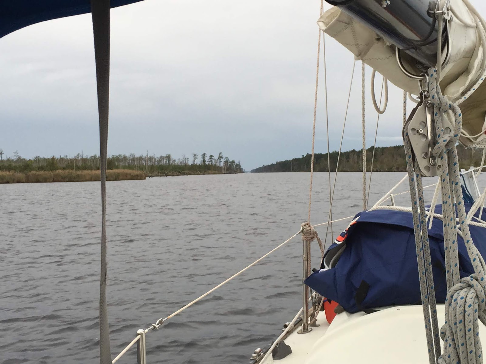
Once out on the Cape Fear River, I was expecting the current to turn against us, but it held with us for about two-thirds of the way down to Southport at the river mouth.  The wind was very light, so conditions were smooth, with none of the wind-driven "rage" conditions that can occur here when wind and current are opposed.  And we made good time.

The next strip of passage down the coast has some of the most badly shoaled parts of the ICW in North Carolina.  Lockwood's Folly, Shalotte's Inlet, these are names that strike caution into the hearts of ICW cruisers.  The Shoals shift constantly, and temporary channel markers are placed and moved to try and keep up with them.  These temporary marke can be very confusing, sometimes deflecting your course to within yards of the inland shoreline!   But if you keep a sharp lookout for them, and follow them, disreguarding whatever your chart (or chartplotter) says, then you should be fine.  And we were, never touching bottom once.

The mega-mansions along this strip of "the ditch" seemed to have fared well, with minimal signs of damage.


As we approached little River Inlet, I noted that a shrimpboat that had been wrecked there in 2016 by hurricane Matthew was still in place on the beach.


We entered Calabash Creek close to low tide, and the tidal range here is large.  Based on my tide charts, the entrance to the creek would drop to 4 1/2 feet, at low tide, which is what we draw!  We would need to be up early tomorrow to get out  before low tide trapped us here for a while.

Once inside, there was plenty of water.  There were already three boats at anchor, lining the edge of the channel, and we took our place at the head of the line.  Later, just at sunset, a fifth boat came and anchored right near the mouth.

Three Boats at Anchor Below Us


Others have reported that this anchorege is bumpy due to all the boat wakes from traffic going into and out of Calibash, but we found the shrimpers to be very respectfull, motoring by all of us at dead slow until they were well past.  Thank you!

And of course, today being Halloween, Joanie broke out our pumpkin shirts.


We fired up the grill and cooked a batch of country ribs and vegetables.

Life is good.

Tuesday, October 30, 2018

Wrightsville Beach

442 nm   N34 12.472   W077 47.937

Our trip today was supposed to take us to Carolina Beach,  but two of the drawbridges along the way only open on the hour, and we lost about half an hour at each one.  So we reset our sights on Wrightsville Beach.  Our friend Mike Scott had told us of a good anchorage in Wrightsville Beach, so we were set to try it.

Part of today's course took us through Camp Lejune.  Sometimes, this military training camp conducts live-fire exercises over the ICW!  In these cases, the ICW is closed off and no boats may pass.  You can call a number 24 hrs in advance to get the next day's schedule, and one of the other boaters on the dock at Swansboro had already done this and found it to be open.
"Live Firing in Progress When Flashing"
But this doesn't that they're not conducting any exercises.  We would periodically hear (and feel) a loud, low-pitched BOOM from beyond the tree line.

We saw more dolphins along the way, but, as usual, they were notoriously difficult to photograph.  One of them came alongside and swam with us for a few moments, but all I got was photos of a grey blur under the water.  And as soon as I started videoing, they disappeared!  I got just this one shot in the distance.
Dolphins
At Wrightsville Beach, once we got through the long wait for the drawbridge, we started hunting for fuel and a pumpout.  Around the corner at Seapath Marina, we found that they had neither fuel nor pumpout, both having been damaged by flooding.  We backtracked to the very busy Wrightsville Beach Marina right on the waterway just below the bridge.  I had skipped it on the way in because of the traffic and strong current.  This is a powerboat marina that caters to megayachts.  But they had fuel, even though it was obscenely expensive.  I also asked the dockhand if they had a working pumpout, and he assured me that they did.  I arranged to stop by first thing in the morning tomorrow when they open at 7am.  (More on this later)

We went in the creek and followed it through two doglegs to the anchorage area just inside the shoreline, separated bu only a narrow barrier island strip.  This is a large and sheltered anchorage, with good holding and room for plenty of boats.  We discovered several boats we kenw already at anchor, including S/V Northstar (who we met in Portsmouth), and S/V Take Five, who we rafted to in Dismal.

After we set the hook, Peter and Ginna from Take Five dinghy'd over to invite us to join them for a trip into town for dinner, which we did.  It was a very pleasant evening.  The food and the company were both excellent.

Life is good.

Monday, October 29, 2018

Swansboro

395 nm  N34 41.165   W077 07.153

Today's plan was to leave Oriental, cross the Neuse River to Adam's Creek, through the canal, down the river to Moorhead City to the coast, and down the coastal ICW to Swansboro.  We had a reservation at Dudley's marina there.  We had considered pressing on further to Mile Hammock, which would position us better for the next day, but were uncertain if we could make it there before dark.

The day started off well enough.  I noted some beautiful anchorages on Adam's creek, and these would be useful in the future for being able to skip Swansboro and make it all the way to Mile Hammock (or vice-versa on the way home).
Adam's Creek
Hurricane Damage along Adam's Creek
Once out on the river, we were able to roll out the jib and motor-sail a bit until we got to Moorehead City Harbor, where our turn westward put the wind too close on the nose.

We got in to Swansboro fairly early.  That's when the fun began.  Had we known what was in store, there would have been just enough time to continue on to Mile Hammock.  Instead, we called Dudley's and followed their instructions to the fuel dock first.  Unfortunately,  Dudley's has become badly silted in since our last visit there, and we were unable to get to the fuel dock without running aground!  Fortunately, its soft mud, and easy to spin off of.  We tried to find a path in repeatedly, but failed each time.  And it was getting worse as the tide was going out.  On top of that, the entrance to the dock they wanted to put us on was past the shoal we kept hitting, so there was no way to get in!

So now we were in a bind.  There was no longer time to get to Mile Hammock, and we knew from past experience that there was no good anchorage south of here before then.  Our only hope was to go into Swansboro harbor and look for a dock we could use (the anchorage there has large currents and poor holding).

Casper's marina was closed (again!) with Hurricane damage to the docks.  The Swansboro town docks were damaged, but the damage seemed to be confined to the fixed docks, with the floating docks mostly intact.  There's about 10 slips there, and a few boats were tied up.  So in we went.  Although the floating dock was in fine shape, the shoreside facilities and restaurant were trashed, and still in the early stages of repair.  Nobody was around.   We figured we'd hang here unless somebody showed up and threw us off!  Fortunately, that didn't happen.   Only two of the pedestals on the dock had power, so we stayed disconnected for the duration.
Shoreside Facilities Destroyed
Docks Damaged

Swansboro was hit pretty badly by flooding from Florence, and they are slowly rebuilding.  But small towns like this don't have much funds, and this limits what they can do.  Big strips of shops were closed, empty, and trying to repair and repaint.  Only a few shops and one or two restaurants were open.  We walked the town and went in a couple of shops that were reopened.

Mermaid Sighting in Swansboro
Clearly, the ducks by the dock were used to handouts from the restaurant patrons.  They immediately surrounded Joanie looking hopeful.

Food???!!!
Tomorrow, we'll try and get all the way to Carolina beach and take a slip in the state park, but it's an ambitious distance, and everything has to go just right to make it before dark.  Our backup plan will be to stop at Wrightsville Beach and anchor there.

Life is good.

Saturday, October 27, 2018

Oriental

347 nm  N35 01.490   W076 41.719

This morning, we got up before dawn, as was becomming our habit, in order to get going at first light. After popping our hatch to take a look around, we discovered that our Anchor light had failed!  I thought the problem was a corroded terminal strip, as this has happened before during this past summer,  but I was going to have to wait for later to troubleshoot it.

The wind was still blowing a pretty good 15 kts, so we made sure everything below was secured snugly, as we expected a bumpy ride today. Again, we have no pics because none of our cameras are waterproof, and it was a wet ride (from spray) .

  Our trip would take us across the Pamlico River, down a canal, across the Bay River, and out onto the Pamlico Sound, and up the Neuse River to Oriental .  The Pamlico Sound is the second largest estuary, second only to the Chesapeake, and it can get quite rough when the winds are up.

Crossing the Pamlico River had a lot of chop, and 1-2 ft swells.  Winds rose to 20 knots.  We were glad to be off of it in the brief respite the canal gave us.  Then more of the same on the Bay River.

Once we turned the corner and were on the Pamlico sound, the winds rose still further to 25 kts. SW, and were just forward of the beam. We rolled out a reefed jib and motor sailed at 6-7 kts! (I will not put anyone on the foredeck to raise the main under these conditions).  I had to start out with the jib furling line on a winch because I was not sure I could get it back in without it!

But it was fun!  We blasted along until the turn onto the Neuse River put the wind so close to our nose that we had to bring the jib in and just motor.  Got into Oriental and took a slip at the Oriental Marina & Inn, and discovered that a Halloween costume party was being held  up on the deck this evening!

We both love Oriental, and always contrive to spend one or two extra days there.  This trip is no exception, and we arranged to stay two nights.

Our friend and fellow P-323 owner Michael Scott lives nearby, and came down to visit and offered to drive us anywhere we needed,  We went out to dinner and then did a quick grocery run.

The next day, Sunday, We walked the town a bit, and were saddened by how many business were shut down by the devastation that hurricane Florence's flooding caused.  Especially sad was the fact that The Bean, the center of coffee and Ice Cream in Oriental, was shut down.  The building survived, but the inside was gutted.  But they are rebuilding, just going to take time. I was told that they managed to save most of the equipment before the floods came.
The Bean is Closed


 Later in the afternoon, another friend who is nearby, David Osborne, came by to visit.  We met David and Kim in Elizabeth City a year and a half ago, as they were just starting out on a Great Loop trip.  Now they are loopers!  Kim was away and unable to come by today.

To finish off the day, Joan whipped up a delicious Steak Marinara, and then we had sundowners with Sean and Eva aboard S/V Emerald Fire

Life is good.

(PS - I had problems uploading the pictures in this post and am almost out of power on my laptop, so I will have to fix them later.  --Ed)


Friday, October 26, 2018

To Belhaven

305 nm   N35 32.261   W076 37.726

A real nice sunrise at Deep Point on the Alligator River.

Sunrise on the Alligator
"Red Sky at Morning, Sailors Take Warning.."  So the ditty goes.  And we were expecting rain today.  But today's travels would take us down the Alligator-Pungo canal (sort of a larger version of the Dismal Swamp Canal) and would very shielded from most wind, limiting the unplesantness.  So, off we went.  Our next destination was Belhaven, a little town with a breakwater-sheltered harbor that would protect us from the weather moving through today and tonight.

It started to rain lightly shortly after we left, so, not a lot of pictures today.  Did get this one before it started.

Entrance to the Alligator-Pungo Canal
At one point, in the rainy distance, I saw what appeared to be two ducks, steadily swimming across the canal in front of us, from one bank to the other.  Imagine my surprise when they reached the far bank and strpped up out of the water, revealing that the "ducks" were actually the heads of two deer!

The rest of the trip to Belhaven was pretty uneventful.  By good fortune, the rain stopped briefly just as we got in, enabling us to set anchor and get below before it resumed.

That night, the front moved through, with 22 knot winds, which made it a little bumpy, but was great for the wind generator!

Joan cooked another one of her fabulous creations, shrimp with tomatos and onions over a bed of brown rice with quinoa.

Life is good.

Thursday, October 25, 2018

Alligator River

First, because I know Mom is reading this and worries, it's NOT called the Alligator River because it's teeming with hungry, man-eating reptiles! It's called that because when you look at it on a chart, it has the shape of an alligator! :)

Dawn Over Elizabeth City Harbor

Anyway, up before dawn, our usual routine when we're on the move, so we can get going by first light and make the most of the short number of daylight hours we have.

Down the river, south of Elizabeth City in the small town of Weeksville, stands the old WWII-era naval blimp airdock, which was used to house blimps that would patrol the coastline in search of German U-boats.  Currently TCOM, a private airship manufacturer, uses the facility for their Ground Systems Manufacturing and Test Facility where they build blimps and airships for everything from surveillance to sporting events.

Old Naval Blimp Airdock and a TCOM airship
 Once down the Pasquotank River, we made our way across the Abelmarle Sound to the Alligator River.  This crossing can often be rough, but we managed to time it so the wind was behind us, so we made a speedy crossing with following seas.  We wanted to go today because tomorrow is rain.

Once across, we passed through the Alligator River swingbridge, and motorsailed all the way to the southern tip of the Alligator River.  With the wind out of the North, it's usually too rough to anchor right at the end of the river, so we turned the corner into the twisty approach to the Alligator-Pungo Canal and anchored off of Deep point with a number of other sailboats.  Joan thawed out a steak and I fired up the grill.

Life is good.

Wednesday, October 24, 2018

Dismal Swamp 2, Elizabeth City

After spending the night rafted up on the Dismal Swamp's Visitor's Center dock, everyone broke raft and headed out early, eager to cover the last 3 miles of the canal and catch the first opening of the South Mills Lock at 8:30.   The last part is some of the narrowest parts of the canal. You have to simultaneously keep track of staying in the center to avoid logs and roots, and keep an eye on the overhanging branches that force you out of the center!

S/V Take Five Squeezing Through
We made it to the lock on time, and locked through without incident.  Well, mostly.  Our locking technique still needs some work.  We've got to decrease our line-handling time so as to have the stern line free and ready the moment the lockmaster presents his boathook for the line.  Even a second or two of fumbling lets the stern swing too far out.

South Mills Lock, Ready for Boats
Get Ready for an Eight Foot Drop!
Once through the lock, the canal gradually widens into a winding river, the Pasquotank, and takes you to Elizabeth City.  We took a slip at the free docks and were helped with our docklines by a couple of friendly natives.
Dolce Vita Tied Up at Elizabeth City
To our surprise, one of the people who helped us identified himself as a "Rose Buddy"!  This tradition of greeting transient boaters had almost died out when its founder died, and we had not been greeted two years ago wnen we were here.  He also informed us that there would be a small wine and cheese party on the deck at 4:30 for all the boaters willing to brave the cold! 

Wine and Cheese Party
Note the Hat: Rose Buddies!
Swapping Sea Stories
Wine, cheese, good company.

Life is good.

Tuesday, October 23, 2018

Dismal Swamp Canal!

206 nm  N36 30.393  W076 21.353

This morning, everyone on the basin got up and left about the same time.  We were all trying to make the first opening of the Gilmerton Bridge after rush hour and get to the 11:00 lock opening.  This all worked pretty much as planned, and just before 11:00 found us all queueing up for the Deep Creek lock into the Dismal Swamp.

Sailboats Queued Up for the Lock
And we're In...

...and Out
The Dismal Swamp Canal is strange and beautiful.  It's miles long, narrow, and straight as an arrow.  The trees overhang the banks, and you have to remain vigilant to not get your mast caught in the branches!  It's so eerie, you're gliding through a heavily wooded forest in a sailboat!

Ahead...
...and Behind
Crossing from Virginia to North Carolina

 About 28 miles in, we reached the Visitor's center dock, our destination for the night.  This free dock allows overnight tieups, but only has space for three boats, so additional boats must raft-up.  We ended up with a total of seven boats.

Five so far...
Towards the dock, we had an experienced cruising couple our age aboard S/V Take Five, and outboard of us, we had a young Canadian couple and their two border collies aboard the S/V Emerald Fire.  We had sundowners aboard Take Five's spacious cockpit before retiring to our separate boats for dinner and sleep.

Tomorrow, we plan to complete the last 3 miles of the Canal, exit via the lock at South Mills, and head down the Pasquotank river to Elizabeth City.

Life is good.

Monday, October 22, 2018

Portsmouth

183 nm  N36 50.138 W076 17.782

Today was another short day from Salt Ponds to Portsmouth, only around 20 nm.  This would position us well to hit the first opening of the Gilmerton bridge after rush hour, and get to the 11:00am cycling of the Deep Creek lock into the Dismal Swamp Canal.

The trip through Norfolk harbor is always exciting, with lots of large military and commercial ships going every which way.  You've really got to keep your eyes peeled.  At one point, I looked up to notice that one of the shoreside cranes appeared to be growing.  It turned to be a crane on a barge, headed directly towards us on a reciprocal course!  I dodged without getting honked, but I truly doubt that he ever saw me before that!

Next, we were overtaken by a warship, a Littoral Combat Ship LCS-16, the USS Tulsa.  This is a trimaran hulled ship, with large flat angular surfaces (stealth?) that looks quite unusual. It came up astern of us, was greeted by two large tugs, which spun it around and let it back up into a mooring.

USS Tulsa

After that, it was tugs, ferries, more tugs...you get the idea.

As we passed Hospital point, mile marker 0 on the ICW, we looked over the anchorage in case we had to come back there if Portsmouth was full.

Our destination was one of the two basins in Portsmouth with free docks.  The first one, the northern one, was a bust.  The seawall was under construction and the free dock was closed.

The second smaller southern basin was open, and only had two other boats in it!  Our strategy of getting here early paid off!  We quickly tied up Dolce Vita and watched as other boats soon arrived.

Dolce Vita Tied Up at Portsmouth
We met two other cruising couples from S/V Pegasus and S/V North Star.  After early sundowners aboard North Star, we all decided to go to a dinner theater in town.  Someone had purchased the old Commodore theater, one of those grand old movie houses that had fallen into disrepair, and refurbished it into a dinner theater that showed first run movies.  We had dinner, drinks, and saw "A Star Is Born".

New Friends
The Commodore Theater
Tomorrow, we'll head for the Dismal Swamp Canal, a visit we've been looking forward to for two years, ever since hurricane Matthew shut it down for a year.

Life is good.

Sunday, October 21, 2018

Interlude

Today was our second day at Salt Ponds.  After the front went through and the rain finished, the winds came, and steadily built up to gale force, making us glad we had decided to wait it out.  Even in the slip, the boat was heeling, and I had to put on extra docklines.

But it was clear and sunny, and in the afternoon the winds abated some, so we took a walk up to the public beach and did some beachcombing.
Bayside Beach at Salt Ponds
Although its not a particularly beautiful beach, I was struck by the cleanliness.  Virtually no manmade trash or debris of any kind!  I was hunting for seaglass, and only found six tiny fragments.

Tomorrow, we will be "back on the road" again, with our next planned stop a free dock in Portsmouth, just across the river from Norfolk.

Life is good.

Saturday, October 20, 2018

A Tale of Two Brackets


A while back, a friend gave me an incomplete Forespar Motormate.  This is a small crane/hoist for lifting the outboard engine off and on the dinghy.  It lacked a base, so I cobbled up something temporary so I could use it.  But the crane was crooked and interfered with the bimini.

My friend and parttime crew, Bill, who is a mechanical designer, saw my kludge and said "I can design a bracket to mount that base and get it fabricated."  Well, he did, but it took the fab shop a while to get to it, and it wasn't ready before we left.  A few days after we left, the bracket arrived (actually, they made two).
Two Brackets
Bill said he needed to make a trip to Southern Maryland anyway, so he would drive them down while we were laid over at Salt Ponds!

So, Saturday afternoon Bill and his wife Lisa showed up. It was still raining a little but cleared shortly.  Bill and I quickly set to work while Joan and Lisa chatted.  In no time, we had the bracket mounted on the transom and the crane setup on top of it.  Everything fit like a glove.  The crane is now nice and straight, and lowered a few inches so it doesn't hit the bimini.
Crane is Straight and Clear
Closeup


For dinner, we went out to a little local hole-in-the-wall Carribbean resturant called the "Stingee Midjit". I had the Jerk Chicken and it was fabulous.
Dinner at The Stingee Midjit
A stop at Baskin Robbins afterwards capped things off nicely.  You can't buy happiness, but you can buy Ice Cream, which is pretty much the same thing.

Life is good.

Friday, October 19, 2018

Down the Bay All the Way

165 nm  N37 03.251  W076 17.240

Our original plans were for our next stop to be Queen's Creek, just south of Deltaville.  This would have been a relatively short day, but we like the Queen's Creek anchorage. 

However, there was a problem.  The weather forecasts showed a front coming through in the next day.  If we went to Queen's creek, we would probably wait there an extra day for the front (and all its rain) to pass so we wouldn't have to travel during squalls. The problem was that after the front passed, there was predicted be strong winds, almost gale force, that would keep us pinned down for another day.

This would be one more day than our small holding tank could accommodate! :(

After looking at the charts last night, I found that if we skipped Queen's Creek, and went directly to our next planned stop, a marina at Salt Ponds (outside of Hampton, VA), it would be about 45 nm.  We had done this kind of distance for the last two days, but this time the wind would be against us, having come around to SSW the night before.  Still, I figured if we motorsailed, and could maintain at least 5.5 kts, we would get there before dark.  The two marinas at Salt Ponds are very well protected on all sides, and would make a good place to wait out the weather.

So, off we went.  The dawn at Sandy Point was pretty, with little wisps of fog drifting over the water.  The boat was heavy with dew, and the temperature was 41 (Back home, they had frost!).
Dawn at Sandy Point
Once we got back out on the bay, it was apparent that we would be able to motorsail close hauled with both Main and Jib.  To my delight, this resulted in a boat speed of 6 kts, which would get us there in plenty of time.
Motorsailing with Main and Jib
As the afternoon wore on, we had to adjust our course closer and closer to the wind, until the jib would no longer pull, so we took it down.  Surprisingly, this didn't seem to hurt our speed, which continued to creep upwards by a few tenths of a knot.

The reason, of course, was the tide.  Starting around 1:00, it had turned in our favor, and was giving our speed-over-ground a boost.  Eventually, even the main stopped pulling, but our speed kept up at 6.2 kts.  It was total luck the tide was in our favor, as it gave us almost a knot extra for free.

We got in to Salt Ponds with plenty of daylight to spare, and the temp had climbed to 66, so we were in good spirits.
Entering Salt Ponds
Salt Ponds is a long, narrow salt marsh that lies just behind and parallel to a narrow barrier island.  The entrance is a rock-lined cut through the island, with a hard 90 degree turn.  Once inside, there are two large marinas, on on either side.  The Salt Ponds Marina and Resort had room for us, so we tied up to their floating docks, secure for the next few days bad weather.
Safe and Sound
Joan made another spectacular dinner of Pork in a tomato-based sauce, butternut squash, and applesauce.  We really do eat well while cruising!

Life is good.

Thursday, October 18, 2018

A Rather Blustery Day

114 nm   N37 49.394  W076 18.899

Be careful what you wish for!

The winds today did indeed come around to the NNW.  They were supposed to be 10-12 kts, but when we got out on the Patuxent River they already blowing 15.  By the time we reached the Bay, they were up to 20, with 2 ft following seas!  And dead astern.  We cautiously unfurled a deeply reefed jib (I was afraid if I let it all the way out, I'd never be able to get it back in!) , and flew along at 6 kts.  Within an hour, the winds had built to 25 kts, 3-4 ft seas, and we were doing 6-7 kts and wallowing all over the place.  The autopilot simply cant handle conditions like this, so we hand-steered

Joanie at the Helm

I got some video as well, and put it up on Google Drive:
https://drive.google.com/open?id=1AwPWE-xNsTX_2XA4VLZAS0kG-pzNz85Q
https://drive.google.com/open?id=1bdKUqmFGUiifr3rh95J_aMnvA15aNVMw
https://drive.google.com/open?id=15ZzGOncRxhFWyuFh7ZbO-uVAyiYH9EcN


Joanie was definitely feeling the cold today.


Brrrrr!
Southbound! Seeking 80! (degrees!)

Later in the afternoon, it eased off back to 15 kts, and then down to 10, so we rolled out the rest of the jib.  And when it eased further to 7 kts, we tried to come up into the wind and hoist the main to go wing-and-wing, but the seas were still lumpy and we were rolling all over the place, and I felt it was just too dangerous to try, so we aborted the attempt and continued on under jib alone.

Crossing the infamous mouth of the Potomac was no more (or less) rough than we had experienced already.  In fact, by the time we reached Smith Point, we were motorsailing in order to reach our anchorage on the Wicomico before nightfall.

Point No Point, North of the Potomac
Smith Point, South of the Potomac
Another 40+ nm day!
We anchored inside of Sandy Point off of the Wicomico, despite the fact that it has no protection to the NNW.  The winds were due to come around to WSW before tomorrow, so I figured we would not be too uncomfortable 'til then.  and right after sunset they did come around and the water laid down still as a mill pond.

Joanie made a great dinner of homemade chili that warmed us up.

Life is good.